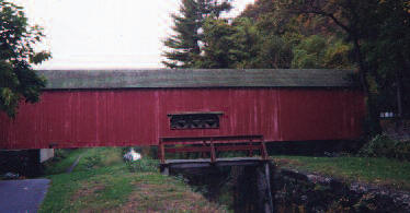
Uhlerstown Covered Bridge
 Coordinates:
(GPS N40’ 31.52” W75’ 04.39”)
(# PA-09-08)
Located on Uhlerstown Road, in Tinicum Township.
Uhlerstown Covered Bridge is a Bucks County bridge.
Description:
Access to the canal tow path that passes under the bridge is available from Tinicum Park, between Erwinna and Uhlerstown, or from the Delaware Canal Park Office, below Upper Black Eddy. Distance to the bridge from Tinicum Park parking area is approximately 1.5 to 1.75 miles.
Uhlerstown Covered Bridge is a little over 101 feet long and has an inside width of 15 ft.11 in with a clearance (height limit) of 11ft., 3in. No weight limit is posted. A unique feature of the bridge is the placement of low set windows on each side of the bridge at the midpoint of the span.
The bridge was completely reconstructed using original fabric in 1985. Locals familiar with the reconstruction recall that each timber was disassembled and repaired or cleaned and then reassembled using the original trunnels (wooden pegs) and timbers wherever possible. A steel multiple-girder undercarriage replaced the original wooden floor system. The bridge and wingwalls received extensive rehabilitation in 2009. Signage at the bridge states that it was originally built in 1832; however that date is disputed by some historians who cite sketchy county records and newspaper accounts of the period suggesting the bridge was built in 1856 at a cost of $2236.75 by local farmer/carpenter Mahlon C. Lear (1820-1889).
Directions:
From River Road (Rt. 32) go west 0.3 mi. on Uhlerstown Road.

